State law restricts Renewable Portfolio Standard alternative compliance fees paid under § 7–705(b) and § 7–705(b)(2)(i)(2) of the Public Utilities Article for use in making loans and grants to support the creation of new Tier 1 renewable energy sources (§ 7-705(b)) and new solar energy sources (§ 7-705(b)(2)(i)(2)) in the State that are owned by or directly benefit certain communities. MEA uses census tracts to identify the communities that meet the specified criteria. Under 7-705(b)(2)(i)(2), individual households outside of these census tracts can also qualify based on income.
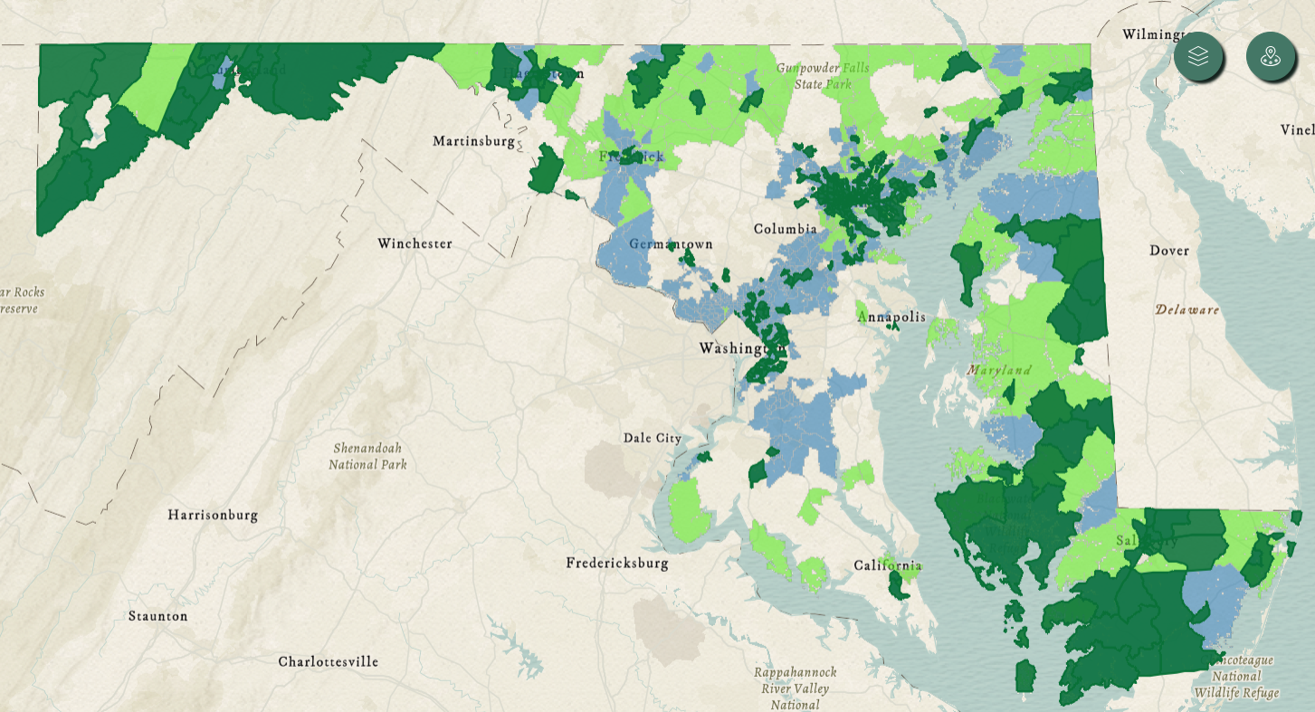
ACP-eligible census tracts are shown on the map above in light green, dark green, and light blue. While the varying colors are the result of multiple data layers, all of the light green, dark green, and light blue ACP areas are eligible.
Cream colored areas are not ACP eligible. While not currently available, MEA is working with state agency partners to develop a searchable GIS map. In the interim, a searchable list of eligible census tracts for FY26 programs is available here (
 PDF
PDF version and
 Excel
Excel version).
Please note that the compliance fees paid under § 7–705(b) and § 7–705(b)(2)(i)(2) of the Public Utilities Article are being used to fund some, but not all, Maryland Energy Administration (MEA) energy programs. A project’s being located in an eligible census tract does not automatically qualify the project to receive a loan or grant. Additionally, for a particular project to be eligible for § 7–705(b) or § 7–705(b)(2)(i)(2) funding, each project must conform to all applicable program requirements outlined in the respective program’s funding opportunity announcement, and be selected for an award by MEA.
Directions for determining a census tract: To determine the census tract for a particular address, the U.S. Census Bureau has developed a
Census Geocoder tool. The tool will identify the census tract based on street address.
- After inputting the address, scroll down to the section entitled “Census Tracts” and find the “GeoID” number.
- Example: MEA’s office location at 1800 Washington Blvd, Baltimore, MD, 21230 is in GeoID #24510210200, also known as Baltimore City census tract #2102.
- The GeoID information from the Census Geocoder tool can then be cross-referenced with the list of eligible census tracts.
- Please note: While the GeoID number is a unique number, several counties can have the same census tract number. When checking eligibility using census tracts, the GeoID number is the preferred way to search.
There is also a
Census map tool that can be used to help visualize the boundaries of each census tract.